Luận án Ứng dụng công nghệ địa không gian để phát hiện sớm mất rừng, suy thoái rừng ở vùng Tây Nguyên, Việt Nam
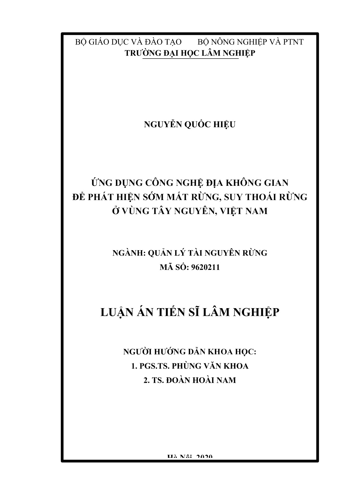
Trang 1
Trang 2
Trang 3
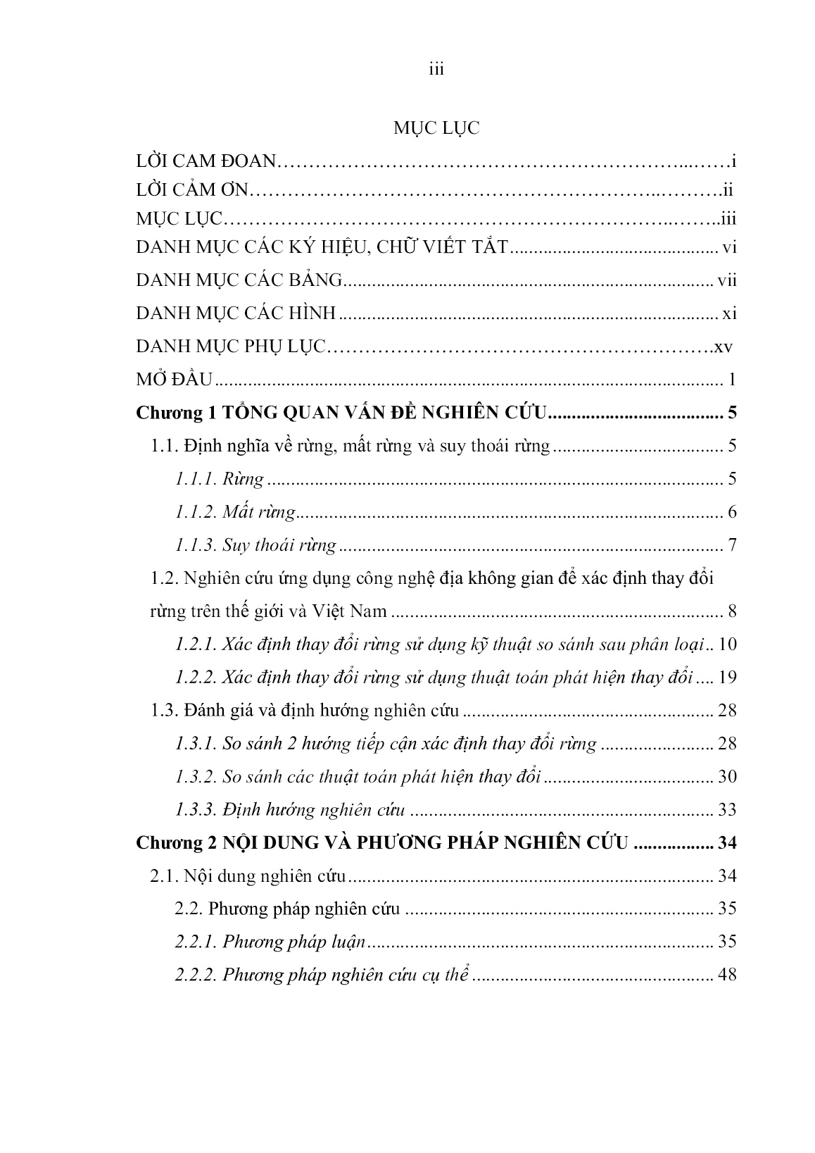
Trang 4
Trang 5
Trang 6
Trang 7
Trang 8
Trang 9
Trang 10
Tải về để xem bản đầy đủ
Bạn đang xem 10 trang mẫu của tài liệu "Luận án Ứng dụng công nghệ địa không gian để phát hiện sớm mất rừng, suy thoái rừng ở vùng Tây Nguyên, Việt Nam", để tải tài liệu gốc về máy hãy click vào nút Download ở trên.
Tóm tắt nội dung tài liệu: Luận án Ứng dụng công nghệ địa không gian để phát hiện sớm mất rừng, suy thoái rừng ở vùng Tây Nguyên, Việt Nam
Sens. 2019, 11, 1719.
158
69. Motlagh, M. G., Kafaky, S. B., Mataji, A., Akhavan, R. (2018). Estimating
and mapping forest biomass using regression models and Spot-6 images (case
study: Hyrcanian forests of north of Iran). Environmental Monitoring and
Assessment; Dordrecht Vol. 190, Iss. 6.
70. Muhd-Ekhzarizal, M. E., Mohd-Hasmadi, I., Hamdan, O., Mohamad-
Roslan, M. K., Noor-Shaila, S. (2017). Estimation of aboveground biomass in
mangrove forests using vegetation indices from SPOT 5 image. Journal of
Tropical Forest Science 30(2): 224–233.
71. Na-U-Dom, T., Mo, X., and Garcia, M. (2017). Assessing the Climatic
Effects on Vegetation Dynamics in the Mekong River Basin. Environments
2017, 4, 17.
72. Parks, S. A., Dillon, G. K., Miller, C. (2014). A New Metric for Quantifying
Burn Severity: The Relativized Burn Ratio. Remote Sens. 2014, 6, 1827-1844.
Remote Sensing; Basel Vol. 6, Iss. 12.
73. Pandey, P. C., Anand, A., Srivastava, P. K. (2018). Spatial distribution of
mangrove forest species and biomass assessment using field inventory and
earth observation hyperspectral data. Biodiversity and Conservation 28:2143–
2162.
74. Planet Team (2017). Planet Application Program Interface: In Space for
Life on Earth. San Francisco, CA. https://api.planet.com.
75. Shishir, S. and Tsuyuzaki, S. (2018). Hierarchical classification of land use
types using multiple vegetation indices to measure the effects of urbanization.
Environ Monit Assess (2018) 190: 342.
76. Santos, S. M. B, António Bento-Gonçalves, A., Franca-Rocha, W. and
Baptista, G. (2020). Assessment of Burned Forest Area Severity and Postfire
159
Regrowth in Chapada Diamantina National Park (Bahia, Brazil) Using dNBR
and RdNBR Spectral Indices. Geosciences; Basel Vol. 10, Iss. 3, (2020): 106.
77. Santana, N. C., Júnior, O. A. D. C., Gomes, R. A. T., and Guimarães, R. F.
(2018). Burned-Area Detection in Amazonian Environments Using
Standardized Time Series Per Pixel in MODIS Data. Remote Sens. 2018, 10, 1904.
78. Thaís, A. L., Beuchle, R., Langner, A., Grecchi, R. C., Griess, V. C. et al.
(2019). Comparing Sentinel-2 MSI and Landsat 8 OLI Imagery for Monitoring
Selective Logging in the Brazilian Amazon. Remote Sensing;
Basel Vol. 11, Iss. 8.
79. Thompson, I. D., Guariguata, M. R., Okabe, K., Bahamondez, C., Nasi, R.,
Heymell, V., and Sabogal, C. (2013). An operational framework for defining
and monitoring forest degradation. Ecology and Society 18(2): 20.
80. UNEP/CBD/SBSTTA (2001). Main Theme: Forest Biological Diversity.
Report Of The Ad HocTechnical Expert Group On Forest Biological Diversity.
Subsidiary Body On Scientific, Technical And Technological Advice, Seventh
Meeting, Montreal, 12-16 November 2001.
81. UNDP, UNEP, World Bank & World Resources Institute (2001). World
Resources 2000-2001 – People and Ecosystems: The Fraying Web of Life.
82. Vorovencii, I. (2014). Assessment of some remote sensing techniques used
to detect land use/land cover changes in South-East Transilvania, Romania.
Environmental Monitoring and Assessment. Dordrecht Vol. 186, Iss. 5.
83. Vorovencii, I. (2014). A change vector analysis technique for monitoring
land cover changes in Copsa Mica, Romania, in the period 1985–2011.
Environ Monit Assess (2014) 186:5951–5968.
160
84. Yang, R., Luo, Y., Yang, K., Liang, H., Zhou, X. (2019). Analysis of Forest
Deforestation and its Driving Factors in Myanmar from 1988 to 2017.
Sustainability. Basel Vol. 11, Iss. 11.
85. Yang, Y., Wang, S., Bai, X., Tan, Q., Li, Q., Wu, L., Tian, S., Hu, Z., Li,
C., Deng, Y. (2019). Factors Affecting Long-Term Trends in Global NDVI.
Forests, 10, 372.
86. Zhong-Ze ZHAN, Hong-Bin LIU, Hui-Ming LI, Wei WU, Bin ZHONG
(2011). The Relationship between NDVI and Terrain Factors: A Case Study of
Chongqing. Procedia Environmental Sciences 12 (2012), 765 – 771.
87. Wang, F. and ·Xu, Y. J. (2010). Comparison of remote sensing change
detection techniques for assessing hurricane damage to forests. Environ Monit
Assess (2010) 162:311–326.
88. https://earthengine.google.com.
PHỤ LỤC
Phụ lục 01. Tóm tắt một số nghiên cứu trên thế giới liên quan đến luận án
TT Tác giả
Địa điểm
nghiên
cứu
Loại ảnh viễn
thám được sử
dụng
Độ chính
xác phân
loại (%)
1 Akay et al. (2017)
Thổ Nhĩ
Kỳ
Landsat 5 TM,
Landsat 8
85,0
2 Amani et al. (2019) Iran Landsat 8 74,0
3 Azzouzi et al. (2015) Algeria Landsat 5, 7 94,0
4 Bhagwat et al. (2017) Myanmar Landsat 5, 7, 8 80,0
5 Dash et al. (2017) Ấn Độ Landsat và IRS 71,8 – 93,3
6 Deus (2016) Tanzania
Landsat TM kết
hợp ALOS PALSA
71,0
7 Devaney et al. (2015) Ai Len ALOS PALSA 97,4
8 Guler et al. (2007)
Thổ Nhĩ
Kỳ
Landsat TM, MSS,
ETM+
83,8 - 87,6
9 Hashemi et al. (2011) Iran Landsat ETM+ 86,0
10 Hoscilo et al. (2019) Ba Lan Sentinel 2, DEM 94,8 – 98,3
11 Kimutai et al. (2016) Kenya
Landsat 5, 7, 8 và
DEM
88,45
12 Yang et al. (2019) Myanmar Landsat 5, 7, 8 83,0 – 93,0
13 Vorovencii (2014) Romania Landsat 5 85,9 - 88,2
Phụ lục 02. Tóm tắt một số nghiên cứu ở Việt Nam liên quan đến luận án
TT Tác giả
Địa điểm
nghiên
cứu
Loại ảnh viễn thám
được sử dụng
Độ chính
xác phân
loại (%)
1
Trần Quang Bảo và
cộng sự (2018)
Đồng Nai Google Earth 81,0
2
Trần Quang Bảo và
cộng sự (2010)
Hòa Bình Landsat TM 86,0; 80,0
3
Chu Thị Bình và
cộng sự (2015)
Hòa Bình Landsat MSS/TM 90,0
4
Nguyễn Quang Giáp
(2015)
Bắc Kạn Landsat 8 81,0
5
Trần Thu Hà và cộng
sự (2016)
Hòa Bình
Landsat ETM, Landsat 8,
VN RedSat-1, SPOT 6
83,0
6
Nguyễn Hữu Hải và
cộng sự (2019)
Quảng
Nam
Landsat 5 TM, Landsat 8 90,0
7
Nguyễn Thu Hiền và
cộng sự (2013)
Quảng
Ninh
SPOT 4
82,74; 80,97;
89,33
8
Đoàn Duy Hiếu và
cộng sự (2016)
Gia Lai Landsat TM, Landsat 8 93,6; 91,6
9
Nguyễn Hải Hòa
(2016)
Hải Phòng Landsat 5, Landsat 8 87,0 – 93,0
10
Nguyễn Hải Hòa
(2016)
Quảng
Ninh
Landsat 5, Landsat 8 83,0 – 92,0
11
Nguyễn Hải Hòa và
cộng sự (2016)
Phú Thọ
Landsat 5, Landsat 7,
Landsat 8
81,7 - 86,5
TT Tác giả
Địa điểm
nghiên
cứu
Loại ảnh viễn thám
được sử dụng
Độ chính
xác phân
loại (%)
12
Võ Minh Hoàn và
cộng sự (2017)
Tp. Hồ
Chí Minh
Landsat 8 83,0
13
Nguyễn Minh Kỳ và
cộng sự (2019)
Gia Lai Landsat 7, Landsat 8 76,0
14
Nguyễn Văn Lợi và
cộng sự (2014)
Sơn La SPOT 5 87,5
15
Nguyễn Văn Lợi
(2012)
Thừa
Thiên Huế
Landsat 7 87,3 – 87,9
16
Nguyễn Thị Ngọc
Quyên và cộng sự
(2016)
Tây
Nguyên
Landsat 8 73,53
17
Nguyễn Văn Thị và
cộng sự (2014)
Hà Tĩnh SPOT 5 76,0
18
Phạm Quang Vinh
và cộng sự (2015)
Điện Biên Landsat 7, Landsat 8 83,0 – 90,0
Phụ lục 03. Một số câu lệnh xử lý ảnh Landsat 8 trong Google Earth
Engine
var startdate = '2015-01-01';
var enddate = '2018-12-31';
var start1 = '2016-01-01';
var end1 = '2017-01-31';
var start2 = '2017-05-01';
var end2 = '2017-12-31'
// Function to cloud mask from the pixel_qa band of Landsat 8 SR data.
function maskcollectionsr(image) {
 // Bits 3 and 5 are cloud shadow and cloud, respectively.
 var cloudShadowBitMask = 1 << 3;
 var cloudsBitMask = 1 << 5;
 // Get the pixel QA band.
 var qa = image.select('pixel_qa');
 // Both flags should be set to zero, indicating clear conditions.
 var mask1 = qa.bitwiseAnd(cloudShadowBitMask).eq(0)
 .and(qa.bitwiseAnd(cloudsBitMask).eq(0));
 var mask2 = image.select('B.*').gt(0).reduce('min');
 // Return the masked image, scaled to TOA reflectance, without the QA
bands.
 return image.updateMask(mask1.and(mask2)).divide(10000)
 .select("B[0-9]*")
 .copyProperties(image, ["system:time_start"]);
}
// Map the function over one year of data.
var collection = ee.ImageCollection('LANDSAT/LC08/C01/T1_SR')
 .filterDate('2015-01-01', '2016-12-31')
 .filterBounds(myArea)
 .map(maskcollectionsr);
var composite = collection.reduce(ee.Reducer.percentile([25]));
// Display the results.
Map.addLayer(composite.clip(myArea), {bands: ['B4_p25', 'B3_p25',
'B2_p25'], min: 0, max: 0.15}, 'Tohop_RGB:432');
print(collection);
 var imagesize = collection.size();
print('Number of images: ', imagesize);
print(collection.count());
// Map a function over the Landsat 8 TOA collection to add an NDVI band.
var withNDVI1 = collection.map(function(image) {
 var ndvi = image.normalizedDifference(['B5', 'B4']).rename('NDVI');
 return image.addBands(ndvi);
});
var withNDVI = withNDVI1.map(function(image) {
 var nbr = image.normalizedDifference(['B5', 'B7']).rename('NBR');
 return image.addBands(nbr);
});
print('My NDVI and NBR:', withNDVI);
var myImagesList = withNDVI.toList(1000); //Make this number larger than
how many images you expect
print('Images',withNDVI);
var imageIDs = myImagesList.map(function(img){
 img = ee.Image(img);
 return img.get('system:index');
});
print(imageIDs);
imageIDs.evaluate(
 function(imageIDsClient) {
 imageIDsClient.map(function(ID){
 var img =
withNDVI.select('NDVI','NBR').filter(ee.Filter.equals('system:index',ID));
 img = ee.Image(img.first());
 Export.image.toDrive({
 image: img.float(),
 description: ID,
 scale: 30, // Set this to resolution (in meters) you want for image
 region: myArea
 });
 });
 }
Phụ lục 04. Một số câu lệnh xử lý ảnh Sentinel 2 trong Google Earth
Engine
var startdate = '2015-11-01';
var enddate = '2019-05-31';
var start1 = '2016-11-01';
var end1 = '2017-03-31';
var start2 = '2017-04-01';
var end2 = '2018-05-31'
function maskS2clouds(image) {
 var qa = image.select('QA60');
// Bits 10 and 11 are clouds and cirrus, respectively.
 var cloudBitMask = 1 << 10;
 var cirrusBitMask = 1 << 11;
// Both flags should be set to zero, indicating clear conditions.
 var mask = qa.bitwiseAnd(cloudBitMask).eq(0).and(
 qa.bitwiseAnd(cirrusBitMask).eq(0));
// Return the masked and scaled data, without the QA bands.
 return image.updateMask(mask).divide(10000)
 .select("B.*")
 .copyProperties(image, ["system:time_start"]);
}
// Select the Sentinel-2 collection-image (ID: COPERNICUS/S2_SR)- Product
L2 level BOA
// and filter it by date, roi and select all bands and aplying cloud mask
var CoimbraBOAS2 = ee.ImageCollection('COPERNICUS/S2')
 .filterDate(startdate, enddate) // Put one day more
 .select('B1','B2','B3','B4','B5','B6','B7','B8','B8A','B9','B11','B12','QA60')
 // Pre-filter to get less cloudy granules.
 .filter(ee.Filter.lt('CLOUDY_PIXEL_PERCENTAGE', 10))
 .filterBounds(roi)
 .map(maskS2clouds);
// Compute Normalized Difference Vegetation Index.
var NDVI = function(image) {
 return image.normalizedDifference(['B8', 'B4']);
};
var NBR = function(image) {
 return image.normalizedDifference(['B8', 'B12']);
};
// Display the clipped collection and the NDVI, with the NDVI palette for
NDVI for visualization
var palette = ['FFFFFF','CE7E45','DF923D','F1B555','FCD163','99B718',
 '74A901','66A000','529400','3E8601','207401','056201',
 '004C00', '023B01', '012E01', '011D01', '011301'];
// Visualize the point on the map
Map.addLayer(CenterNuno, {color: COLOR.CenterNuno});
//Add the NDVI as band to do the serie
var NDVIserie1 = CoimbraBOAS2.map(function(image) {
 var NDVI=image.normalizedDifference(['B8', 'B4']).rename('NDVI');
 return image.addBands(NDVI);
});
NDVIserie = NDVIserie1.map(function(image) {
 var NBR=image.normalizedDifference(['B8', 'B12']).rename('NBR');
 return image.addBands(NBR);
});
// The same collection but now we select NDVI only in the selected roi/point
var NDVIserie = NDVIserie.filterBounds(myArea).select('NDVI', 'NBR');
print(NDVIserie);
print (CenterNunoTimeSeries);
print('Done')
//print (NDVICenterNunoTimeSeries);
var S2 = ee.ImageCollection('COPERNICUS/S2')
 .filterDate(startdate, enddate) // Put one day more
 .select('B1','B2','B3','B4','B5','B6','B7','B8','B8A','B9','B11','B12','QA60')
 // Pre-filter to get less cloudy granules.
 .filter(ee.Filter.lt('CLOUDY_PIXEL_PERCENTAGE', 10))
 .filterBounds(roi)
// Export properties (including ID) for each image to a csv file
var imageProperties_OK = S2.map(function(img){
 var fout1 = ee.Feature(img.geometry());
 return fout1.copyProperties(img);
});
var myImagesList = NDVIserie.toList(1000); //Make this number larger than
how many images you expect
print('Images',NDVIserie);
var imageIDs = myImagesList.map(function(img){
 img = ee.Image(img);
 return img.get('system:index');
});
print(imageIDs);
imageIDs.evaluate(
 function(imageIDsClient) {
 imageIDsClient.map(function(ID){
 var img = NDVIserie.filter(ee.Filter.equals('system:index',ID));
 img = ee.Image(img.first());
 Export.image.toDrive({
 image: img,
 description: ID,
 crs: 'EPSG:4326',
 scale: 10,
 region:myArea
 });
 });
 }
);
Phụ luc 05. Thông tin về 360 mẫu rừng không đổi để đánh giá biến động chỉ số viễn
thám theo thời gian và xác định ngưỡng KB rừng không đổi
TT Tên tỉnh Kiểu rừng X Y TK
Khoản
h
Lô
Diện
tích
(ha)
1 Kon Tum G-TN
78448
9
158526
1 688 3 7 47.41
2 Kon Tum G-TN
78433
7
159124
4 660 7 4 45.58
3 Kon Tum G-TN
77946
0
158217
3 692 1 3 97.96
4 Kon Tum G-TN
79416
0
158156
8 634 5 3 76.14
5 Kon Tum G-TN
79433
7
158281
7 634 2 2 47.25
6 Kon Tum G-TN
78816
0
158990
8 662 7 5 53.05
7 Kon Tum G-TN
79042
8
159008
5 662 6 4 54.55
8 Kon Tum G-TN
77060
6
159133
4 668 2 8 5.9
9 Kon Tum G-TN
76092
7
158258
8 681 8 4 18.47
10 Kon Tum G-TN
78709
5
159000
6 677 1 2 40.16
11 Kon Tum G-TN
76212
2
158411
8 681 5 5 44.53
12 Kon Tum G-TN
77056
0
159017
3 668 7 1 14.77
13 Kon Tum G-TN
77382
1
159919
7 646 1 1 112.2
14 Kon Tum G-TN
75985
3
158317
8 680 3 4c 26.77
15 Kon Tum G-TN
79358
7
157608
2 642 2 1 80.04
16 Kon Tum G-TN
78288
8
158764
7 670 4 2 53.28
17 Kon Tum G-TN
76834
7
158707
9 682 3 1 26.37
18 Kon Tum G-TN
79157
8
158240
5 635 2 1 95.12
19 Kon Tum G-TN
77684
5
157995
4 693 4 3 34.34
20 Kon Tum G-TN
76715
3
159031
4 666 4 15 20.04
21 Kon Tum G-TN
78419
7
158667
0 688 1 4 44.63
22 Kon Tum G-TN
78468
9
158918
1 660 11 3 23.45
23 Kon Tum G-TN
78531
7
159511
5 649 9 3 42.47
24 Kon Tum G-TN
78624
4
159370
9 654 2 3 56.66
25 Kon Tum G-TN
77771
3
157788
2 698 7 1 51.15
26 Kon Tum G-TN
78235
9
158487
6 687 5 4 92.17
27 Kon Tum G-TN
78446
2
159643
4 648 9 4 41.33
28 Kon Tum G-TN
78844
8
157609
6 701 10 3 87.7
29 Kon Tum G-TN
78873
8
157869
8 701 4 2 110.54
30 Kon Tum G-TN
77376
9
155761
8 758 7 1 130.06
31 Lâm Đồng G-TN
78476
8
129867
1 399 8 4 68.8
32 Lâm Đồng G-TN
78094
5
129788
5 417 6 12 33.02
33 Lâm Đồng G-TN
77897
0
129367
4 428 7 3 60.39
34 Lâm Đồng G-TN
78076
4
129498
6 430 2 6 14.08
35 Lâm Đồng G-TN
75933
9
129998
4 497 7 5 62.75
36 Lâm Đồng G-TN
76013
6
130026
6 497 7 4 21.6
37 Lâm Đồng G-TN
75375
5
129476
5 501 5 2 74.97
38 Lâm Đồng G-TN
75194
3
129290
5 501 8 3 143.82
39 Lâm Đồng G-TN
75529
8
129527
7 502 2 3 103.45
40 Lâm Đồng G-TN
75842
5
129306
4 509B 3 5 40.07
41 Lâm Đồng G-TN
76207
6
129978
7 504B 2 4 17.51
42 Lâm Đồng G-TN
76105
4
129835
3 504B 4 6 29.67
43 Lâm Đồng G-TN
77025
8
129597
5 507 6 6 35.52
44 Lâm Đồng G-TN
76918
1
129530
1 507 8 2 35.55
45 Lâm Đồng G-TN
76440
1
129509
7 508A 8 14 21.02
46 Lâm Đồng G-TN
76227
3
129633
5 509A 3 7 56.85
47 Lâm Đồng G-TN
75929
6
129547
5 509A 7 2 61.07
48 Lâm Đồng G-TN
77064
2
128947
7 527 6 5 78.67
49 Lâm Đồng G-TN
76836
0
128426
7 536 10 2 30.19
50 Lâm Đồng G-TN
76726
6
128345
7 536 11 7 32.18
51 Lâm Đồng G-TN
77035
2
128693
0 536 6 2 22.98
52 Lâm Đồng G-TN
77022
1
128541
8 536 7 6 54.84
53 Lâm Đồng G-TN
78381
4
128501
3 523 10 1 94.33
54 Lâm Đồng G-TN
78177
4
128388
6 540 6 1 120.29
55 Lâm Đồng G-TN
77881
1
129220
4 520 6 1 68.38
56 Lâm Đồng G-TN
78320
2
128207
2 541 5 1 162.66
57 Lâm Đồng G-TN
78520
0
128199
4 544A 3 3 100.91
58 Lâm Đồng G-TN
78111
0
128023
8 545 4 2 76.04
59 Lâm Đồng G-TN
78690
3
127975
6 557 4 3 111.49
60 Lâm Đồng G-TN
78645
3
127758
5 561 7 1 135.92
61 Kon Tum LK
78273
5
168006
0 31 3 2 80.16
62 Kon Tum LK
80691
5
167576
8 65 1 6 45.31
63 Kon Tum LK
82669
6
165174
4 237 2 45a 10.61
64 Kon Tum LK
78054
2
167972
1 29 14 5 66.86
65 Kon Tum LK
77505
5
165954
2 118 8 1 134.43
66 Kon Tum LK
77439
7
165686
0 122 8 1 72.56
67 Kon Tum LK
78695
7
168393
3 15 5 4 76.68
68 Kon Tum LK
81082
6
166560
3 75 8 1 142.47
69 Kon Tum LK
80381
0
167525
9 64 4 27 36.58
70 Kon Tum LK
78580
2
166383
5 42 5 1 52.52
71 Kon Tum LK
78472
8
167695
1 30 16 1 90.66
72 Kon Tum LK
80448
3
165856
5 203 8 17 10.31
73 Kon Tum LK
80518
1
165983
4 203 6 4 6.8
74 Kon Tum LK
81096
7
166747
1 75 5 1 100.5
75 Kon Tum LK
78453
5
166447
3 43 4 2 48.35
76 Kon Tum LK
77323
2
166012
4 118 6 2 134.37
77 Kon Tum LK
78072
5
165773
1 119 9 2 82.86
78 Kon Tum LK
77204
9
165807
2 122 4 1 109.71
79 Kon Tum LK
77704
3
165805
1 123 2 2 108.16
80 Kon Tum LK
80271
2
167482
7 63 4 13 22.69
81 Kon Tum LK
78373
5
167304
5 34 10 1 120.82
82 Kon Tum LK
80575
5
165946
4 203 5 32 6.56
83 Kon Tum LK
78167
3
168188
7 29 6 4 52.01
84 Kon Tum LK
82823
4
165141
4 237 4 25 8.92
85 Kon Tum LK
82908
1
165141
2 237 6 19 6.77
86 Kon Tum LK
78461
3
167874
8 30 11 1 90.76
87 Kon Tum LK
78349
5
168116
8 31 1 1 77.26
88 Kon Tum LK
78284
4
167653
7 31 16 2 89.25
89 Kon Tum LK
78237
7
167893
2 31 9 1 126.01
90 Kon Tum LK
78378
3
167519
9 34 2 2 95.11
91 Lâm Đồng LK
89463
4
133502
7 122 12 8 7.97
92 Lâm Đồng LK
89378
4
134330
0 123 3 17 4.01
93 Lâm Đồng LK
89527
3
134332
3 123 4 18 7.63
94 Lâm Đồng LK
89628
0
133474
2 129 3 9 1.73
95 Lâm Đồng LK
89574
9
133390
3 129 6 11 4.3
96 Lâm Đồng LK
89546
6
133818
9 130 3 5 16.64
97 Lâm Đồng LK
89417
9
134521
5 93 7 7 37.07
98 Lâm Đồng LK
89288
3
134274
8 94B 7 6 7.14
99 Lâm Đồng LK
88748
5
133683
5 121 4 11 18.91
100 Lâm Đồng LK
88819
7
133705
9 121 5 22 7.63
101 Lâm Đồng LK
89066
6
133778
0 121 7 1 8.45
102 Lâm Đồng LK
89050
4
134348
1 94A 8 10 30.22
103 Lâm Đồng LK
88984
7
133513
6 132 2 14 11.74
104 Lâm Đồng LK
89010
5
133539
6 132 2 8 10.52
105 Lâm Đồng LK
88881
4
133056
7 134 4 20 10.43
106 Lâm Đồng LK
88835
3
133011
9 134 5 14 11.6
107 Lâm Đồng LK
89047
2
133178
8 135 1 7 26.07
108 Lâm Đồng LK
89796
0
133179
5 137 1 11 8.07
109 Lâm Đồng LK
89671
3
133159
9 137 2 4 12.55
110 Lâm Đồng LK
89701
6
133073
6 137 2 12 6.12
111 Lâm Đồng LK
89651
4
132901
8 137 5 5 59.2
112 Lâm Đồng LK
89999
2
133116
9 138 2 11 5.87
113 Lâm Đồng LK
89892
0
133169
4 138 3 1 13.48
114 Lâm Đồng LK
90057
3
132965
1 138 4 20 21.35
115 Lâm Đồng LK
89927
1
133021
5 138 4 6 12.02
116 Lâm Đồng LK
89957
9
132696
4 138 7 4 54.38
117 Lâm Đồng LK
89569
6
132657
0 139 2 2 51.82
118 Lâm Đồng LK
89559
6
132848
7 139 3 1 35.95
119 Lâm Đồng LK
89642
5
132804
1 139 4 3 5.02
120 Lâm Đồng LK
89790
4
132855
4 139 6 3 24.95
121 Đắk Lắk RL
79639
5
141612
5 522 6 18 2.63
122 Đắk Lắk RL
79464
7
141612
7 522 5 28 4.98
123 Đắk Lắk RL
79270
9
1
File đính kèm:
 luan_an_ung_dung_cong_nghe_dia_khong_gian_de_phat_hien_som_m.pdf
 CV DeNghiDang Web ncs.NguyenQuocHieu.pdf
 TomTatLuanAn (TiengAnh) - ncs.NguyenQuocHieu_DHLN.pdf
 TomTatLuanAn (TiengViet) - ncs.NguyenQuocHieu_DHLN.pdf
 TrangThongTinDongGopMoi (Viet-Anh) - ncs.NguyenQuocHieu_DHLN.docx
 TrichYeuLuanAn (Viet-Anh) - ncs.NguyenQuocHieu_DHLN.docx

